
Hungary 2013
is a locked country located in Central Europe. Surrounded eighbouring countries, Austria, Slovakia, Ukraine, Romania, Serbia, Croatia, Slovenia


Entering Budapest on the Liberty Bridge, was one of the first suspension bridges built in the World
City of Budapest
Hungary;s capital city is located on both side of the River Danube. The iconic 19th Centuary Chain Bridge is the closest connection between the dissected city.
Buda is built on a hilly side of the Danube and Pest is on the flat Plains
A funicular car runs up Castle Hill to Buda’s Old Town, where the Budapest History Museum traces back to Roman times. Budapest is famous for its Thermal Springs

Vajdahunyad Castle is an ancient castle in the City Park of Budapest,


The statue of the Chronicler named Anonymus


Heroes' Square along with its surroundings, the Millenium Underground Railway have been added on to the UNESCO World Heritage List in the year 2002. In the middle stands the Millenium Monument, with Archangel Gabriel on top, holding the double cross of Christianity and the Holy Hungarian Crown.It was constructed to mark the 1000th anniversary of the arrival of the Magyar tribes.


Our Sorento on the Historic Chain Bridge to Buda Old District and Castle Hill.

The Chain Bridge is the oldest bridge ib Budapest and was erected in 1849.


One of Budapest's most famous building, the Mathias Church, is over 700 years lacated at the Trinity Square


Statue of St Stephen
Budapest's the views of the Danube embankments and the Buda Castle District, , is the most beatutiful and romantic part of the City was made a World Heritage site in 1987
The Gellért Bath, the Gellért Hill with the Statue of Liberty and the Citadel, the Castle of Buda, the Baroque churches and Turkish Baths all are Heritage Buildings with a 800 year history.

A fanfastic view of Buda's embankments and River Danube
The Fishermen's Bastion, was completed in 1902, replacing the former castle wall, and it offers breathtaking views of Budapest, The Chain Bridge and the Danube embankment buildings, dominated by The Parliament House


Chain Bridge and Pest viewed from Buda's Castel Hill


Parliament House and St. Stephen's Basilica can be seen on top right
The next country we is Armenia then Iran etc See: www.klglasgowoverland.blogspot.com
INDIA -2013
We entered India at 11.10am and it took an hour and a half to clear the India Custom / Immigration formalities. We left the border at 1pm and went in search of lunch near Attari village. There isn't any freshly cooked food, we made do with simple sandwiches we made ourselves and fruits for lunch.
We hang around for a few hours as we waited for the Wahga Border Closing / Flag Lowering Ceremony at 5pm.

Leaving Lahore on the Grand Trunk Road (GT Road) to Wahga Border.


16km to Wahga border

Buffaloes on the move

Arriving at the Pakistan gate after clearing Pakistan Custom / Immigration formalities.


Border patrol checking our documents before allowing us to leave Pakistan

India Border Gate.. a few metres away


Crossing into India
________________________
Wahga Border Closing Ceremony
The Wahga Border Closing Ceremony takes places daily in the evening on both the Pakistan and India sides. The atmosphere is electric, music blaring, locals running up and down the length of the podium carrying the national flags with pride displaying their patriotism. The crowd quietened for a while when the official ceremony begins but soon starts to cheer again when the soldiers begin their elaborate energetic march. The border closing ceremony ends when the flags of both countries are lowered and the gates closed.
We watched the ceremony on the India side.


Locals carrying their national flags with pride while waiting for the Wahga Border Closing Ceremony to begin

Even kids dance along to the music to show their patriotism

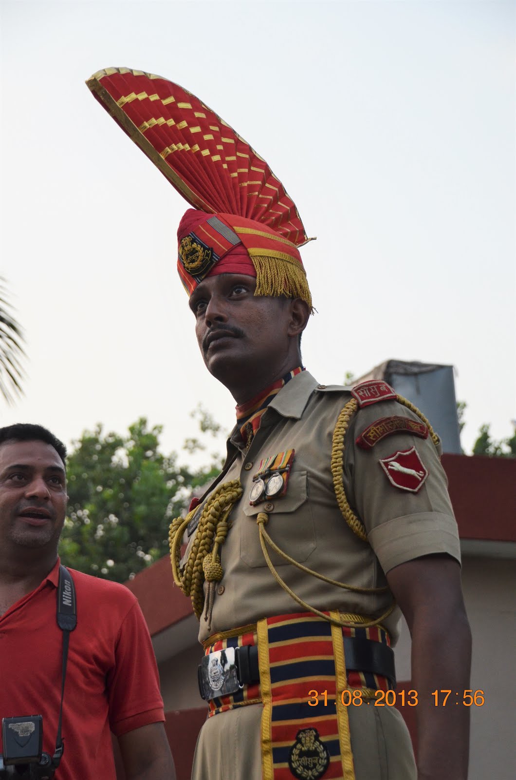
Mum standing next to an Indian Border Guard in their ceremonial dress. They are very tall!


Wahga Border Closing Ceremony in progress
Video of Wahga Border Closing Ceremony:
To watch this video go to

Iindia and Pakistani Border Guard lowering their respective Flags.

India and Pakistan flags being lowered simultaneously on both sides

The final march-past of the closing ceremony

The end of the Wahga Border Closing Ceremony. Gates on both sides are now closed.

Route from Srinagar to Leh to Manali.
Our Sorento's Overland trip in North India's Kashmir Region and The Ladakh
The Kashmir/Ladakh Region
famously called the "Land of Mountain Passes" is a rugged yet beautiful mountainous Region in the far North of India in the Himalayas Ranges . A sight to behold in awe, its breathtaking views and vistas makes a lifetime experience
Kargil being the closes Town to the border with Pakistan, where a few skirmishes have occurred.
These are the high Mountaun Passes which we will be driving from Srinagar to Leh and on to Shimla.
Namika La Pass
Srinagar-Leh Highway NH 1D , Elevation - 3,720m (12,198ft)
- The second highest Pass on the 434km Srinagar-Leh Highway (NH 1D), between the villages of Mulbekh and Saraks / Khangral


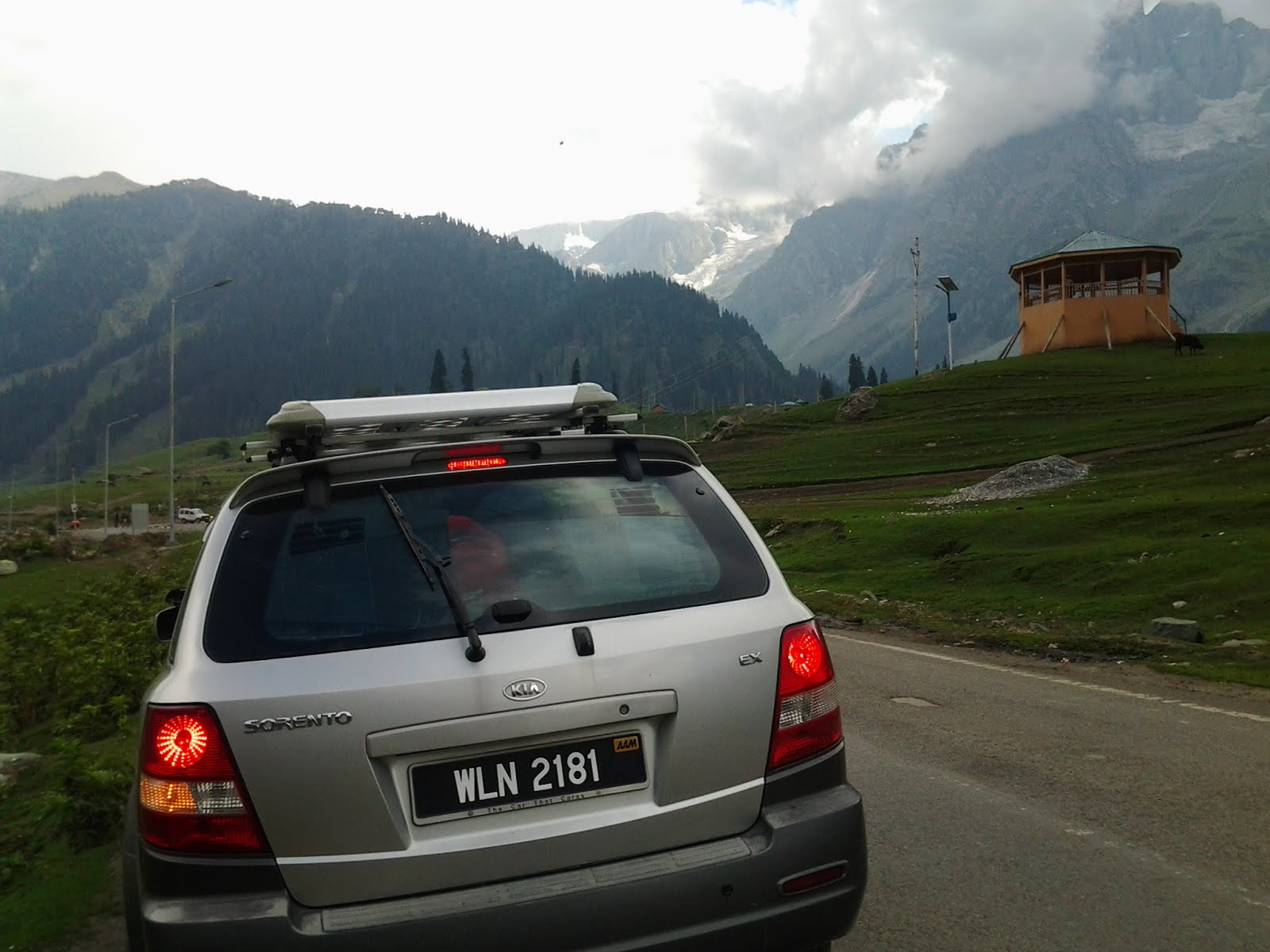
Our Sorento and the Tahjiwas Glacier at Sonamarg Khasmir

Tahijwas Glacier
 Sind River Valley
Sind River

Zoji La Pass(Leh /Srinagar HW1D
Elevation - 3,530m (11,649ft)
The third highest pass on the 434km Srinagar-Leh Highway (NH 1D), between the town of Sonamarg and Drass


Heading up to Leh from Srinagar
Fotu La Pass
Elevation - 4,108m (13,479ft)
Fotu La is the highest pass on the 434km Srinagar-Leh Highway (NH 1D), situated between the villages of Heniskot and Lamayuru


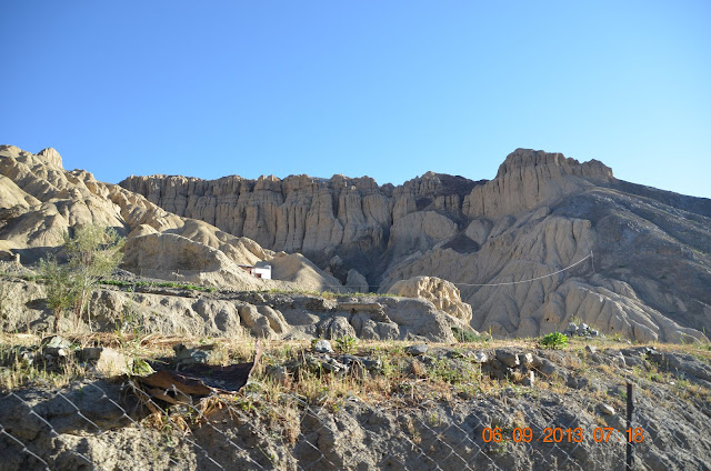
- As we descend Fotu La Pass, we arrive at the small village of Lamayuru. We are about 120km west of Leh and driving on the Srinagar-Leh Highway / NH1D.Our surroundings changed and as we enter an area with moon like landscape. This is India"s own Moonland landscape that made the small village of Lamayuru famous with its strange natural lanscapes with both local and foriegn tourists.


India's own Lunar Moon Scape ...... near Lamayuru


Saspul Village


Little girl following grandma to run errands at Saspul Village waves at us

Coming over to get a closer look...

Stupas and Mani walls as we leave Saspul Village

Group of cyclist taking a rest
 Basgo Gompa The Maitreya Temple built around the 15th Century is a World Heritage Site...in Ladakh 44 KM from Leh. Sadly natural erosion are destroying the temple
Nimmoo Village


Arriving at Leh, the Capital of Ladakh


Leh is a town in Leh district in the Ladakh region of northern India. It was also the capital of the Himalayan kingdom of Ladakh, the seat of which was in the Leh Palace, the former mansion of the royal family of Ladakh, built in the same style and about the same time as the Potala Palace in Tibet. Leh is at an altitude of 3,524 metres (11,562 ft), and is connected via National Highway 1 to Srinagar in the southwest and to Manali in the south via the Leh-Manali Highway. In 2010, Leh was heavily damaged by the sudden floods caused by a cloud burst.


Rumtse Village


Taglang La 5,358 metres
is in Northern India in Zanskar/Ladakh Region on the road from Manali to Leh in the Himalayan Main Range. The paved road is one of the highest paved road in the World at above 17,582feet high

Driving up Taglang La at an altitude of 4616metres


Taglang La Loops


Taglang La Loops

Our Sorento needs a rest and cooling down afer the long climb


Taglang la Pass

Driving up the Taglang Pass


Taglang la Pass

Driving up the Taglang Pass


A a enchanted and happy traveller....Ladakh Land that make you smile
Driving up the Taglang

Icie needles Cliffs....

This parts of the mountain still held on the ice


This parts of the mountain still held on the ice

Making our mark in Ladakh as we did in Andorra and Turkey


Driving down from Tanglang La Pass.
Rugged Landscapes
Woman washing clothes in the clean fresh mountain stream.
Rumtse Village
Local Villagers.
Taglang La 5,358 metres
is in Northern India in the Zanskar/Ladakh Region on the road from Leh to Manali in the Himalayan Main Range. The paved road is one of the highest paved road in the World at above 17,582feet high
Location of the Tanglang La Pass
Driving up Taglang La at an altitude of 4616metres as shown on our GPS
Taglang La Loops
Our Sorento needs a rest and cooling down afer the long climb
Taglang la Pass
An enchanted and happy traveller....Ladakh Land that make you smile
Driving up the Taglang Pass
Ice needles Cliffs....
Making our mark in Ladakh on the drive up the Tanglang La pass as we did in Andorra and Turkey
Our Sorento too made up to one of the highest Mountain Road in the World ...The Tanglang Pass at an elevation of 17,582 feet.

Standing proudly on the top of one of the highest paved roads in the World
The Gata Loops
Gata Loops (Kelong Leh Road in Ladakh) is a 10km decending road that runs along the Tsarap River.. It is series of 21 challenging hairpin bends decending from Nakee La Pass road meeting at the Tsraap River

Gata Loop in Ladakh South of Pang Village after Nakee la Pass The 12 bend loop ends at the Tsaarp River


Taking the Gata Loops to Sarchu onwards to Manali


The Tsarap River

Driving to Sarchu


Elevation at 4703m

A Buddhist Temple above

Huge rocks breaking off on the road.....just be a hairpin curve

Driving to Kelong


Men build Nature destroy...hairpin bend ahead


No comments:
Post a Comment