

Friday 23 August 2013
Pakistan. Mastuj to Chitral and the Kalash Villages, near Aryun. 2013
Mastuj is in the Khyber Paktunkhwa Region of Pakistan
We left Mastuj with a lone Police Escort....driving South West through the Mountains to Chitral and The Kalash People Villages near Aryun
We left Mastuj with a lone Police Escort....driving South West through the Mountains to Chitral and The Kalash People Villages near Aryun

Thursday 22 August 2013
Pakistan. Gupis to Shandur Pass along the Gilgit River Valley 2013
Shandur Pass is located between Chitral District of Khyber Pakhtunkhwa and Ghizer District of Gilgit-Baltistan as a common shared pass. It is often called the 'Roof of the World'.
Getting oof the KKH after Gilgit City and taking the Chitral Gilgit Road to Shandu Pass/Top and beyond is the most rewarding part of our trip from Kungerab Pass . The scenery is most captivating, the turquoise coloured Gilgit River is never ending as we drove. Green River Valleys stretching from Gupis Town to Shandu Pass is the most beautiful. Shandu Top Highlands is worth the detour getting off the KKH.


Getting oof the KKH after Gilgit City and taking the Chitral Gilgit Road to Shandu Pass/Top and beyond is the most rewarding part of our trip from Kungerab Pass . The scenery is most captivating, the turquoise coloured Gilgit River is never ending as we drove. Green River Valleys stretching from Gupis Town to Shandu Pass is the most beautiful. Shandu Top Highlands is worth the detour getting off the KKH.
Pictures below describes it all.

Gilgit River

Wednesday 21 August 2013
Pakistan KKH Ali Abad to Gilgit and Dunyore 2013
We left Ali Abad village for Gilgit City.

Lush green field.
Tuesday 20 August 2013
Pakistan Our Sorento crossing the Attabad Lake (aka Hunza Lake / Gojal Lake) 2013
Hunza Valley, North Pakistan
Hunza is located in the Gilgit Baltistan region in the north of Pakistan. We are travelling the stretch from Passu village to Attabad village.


Monday 19 August 2013
Pakistan Karimabad and Aliabad 2013
By now our Sorento have been offloaded from the boat that had taken her across the Attabad Lake over the section of the Karakoram Highway (KKH) that is now fully submerged. Click on the link to read more about our Sorento's Attabad Lake crossing. near Passau
We rejoined the KKH Highway and after fifteen minutes of dirt road from the New Lake, we are back on paved road again.

The blueish of blue waters of Attabad Lake...natural 'dam' caused by a massive glacier landslide that swept away the road connecting Attaabad Village and Karimabad Village.....a new road is under construction . Local, visitors, goods, local produce and vehicles from either side use Ferry large boats
Sunday 18 August 2013
Pakistan Driving on the world's highest paved international road - the KKH 2013
Khunjerab Pass at the Pakistan / China border, to Sost, North Pakistan.

The KKH is the world's highest paved international road connecting Pakistan to the ancient silk road. The KKH begins in Kashgar, China and goes for 1,300km to Abbotabad, in Pakistan

The Monument is the common border marking the two countries. Its also marks the beginning of another adventure for us. Taking the Karakoram Highway will not be challenging as a new paved highway is being built but we are looking forward to face the Attabad Lake crossing.
Fantastic, amazing scenic views awaits us to Passu at Lake Attabad. Mountain Peaks, blue/green/ turquoise Rivers, Green lusch valleys, Villages, Farms and Glaciers await us. Its going to be our dream adventure of a lifetime, especially Dad who was inspired to make the Lake crossing on a boat ....with no lashing...no life jackets.....his dream ....high up in the Himalayan Mountain Range.
Thursday 15 August 2013
China Kashgar City, 2013
Kashgar is a city in the Xinjiang Uighur Autonomous Region, in China’s far west. It was once servedd as a main stop along the ancient Silk Road for 2000
years Kashgar is also the northern point of the Karakoram Highway connecting China and Pakistan.
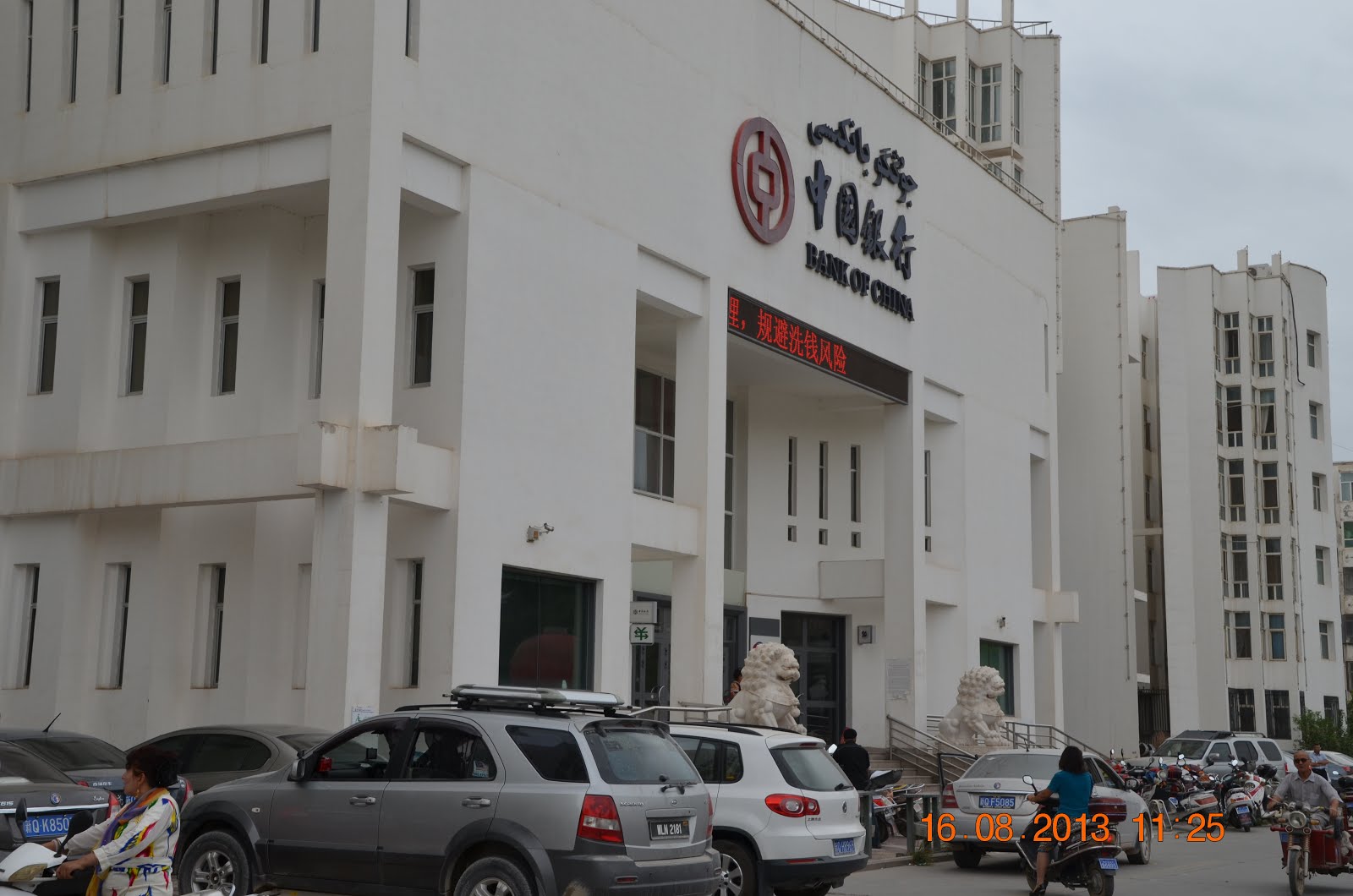
Our Sorento parked in front of the Bank of China. Got to change some Chinese Yuen before we tour Kashgar city.
Wednesday 14 August 2013
China. Tourgat Pass to Kashgar. 2013
China Krygyzstan Border. Waiting for our China guide to arrive.


Scenic drive through At-Bashy mountain range and a visit to a 15th century stone relic, the Tash Rabat Caravanserai
Tash Rabat Caravanserai is a well preserved ancient stone relic from the 15th century. It used to provide shelter to traders, merchants and travelers on the old Silk Road. Located inside the At-Bashy mountain range, with the structure half tucked into the mountain side, our drive in the valley takes us through some pretty scenic rocky mountains.

Turn off the main A365 and onto the dirt road that goes through the At-Bashy mountain range to Tash Rabat
Torugart Pass and Krygyz / China border crossing
We left Tash Rabat Caravanserai and was back on the A365 heading to Torugart Pass at 4.30pm. Tash Rabat was at an elevation of 3,200m. On the other hand, Torugart Pass is at 3,752m above sea level. The sun was out but the temperature was a cool 11°C.
Torugart Pass is also the Kyrgyz China border crossing point. As we were only scheduled to cross the border into China on 15th Aug, we would stay the night on the Kyrgyz side of the border and cross it the next morning.

Such happy horses... on the A365, after the junction to Tash Rabat.

Good paved road as we drive alongside the At-Bashy mountain range.
Tuesday 13 August 2013
Son Kul Lake to Naryn via Moldo Ashuu Pass
We had our half boiled egg with bread and tea breakfast by the lake and prepared a simple lunch to have later on our way through the mountain pass.
Today, we leave Son-Kul Lake and make our way down to Naryn city via the Moldo Ashuu pass.
Today, we leave Son-Kul Lake and make our way down to Naryn city via the Moldo Ashuu pass.

After driving for about 13km, we are at Moldo Ashuu Pass.
At this point the elevation is 3,250m. Moldo Ashuu Pass goes up to 3,346m above sea level.
From here, the dirt road zig zags, jumping from the side of one hill to the next as we make our way to lower ground.
Sunday 11 August 2013
Kochkor to Son-Kul Lake via Kalmak Ashuu Pass

From a distance, this looked like a small settlement with ornately constructed structures...
Friday 9 August 2013
The south shores of Issyk Kul Lake - Jeti Oguz to Kochkor
Jeti Oguz, translates as ‘Seven Bulls’, the name comes from the large red-rock cliffs that resemble, you guessed it, seven bulls. Jeti Oguz is around 30km from Karakol,


Thursday 8 August 2013
The south eastern edge of Issyk Kul Lake - Karakol city
Karakol is a major city on the south eastern edge of Issyk-Kul Lake and the fourth largest city in Kyrgyzstan.
Dungan Mosque
The Dungan mosque with distinctive Chinese influence was built by the Dungan community, the Chinese Muslim refugees who fled persecution in their home country in the late 1800s.

Scenic drive in Karkyra Valley and onwards to Ak Suu
We left the shores of Issyk-Kul Lake for a day at Kuturga and drove along the A363 towards Tyup village. At Tyup, instead of continuing on the A363 to the southern shores of Issyk-Kul Lake, we decided to turn left onto A362 and drive east along Karkyra Valley.
It's cold this morning. Temperature about 20°C.

Issyk-Kul Lake and snow capped Tien Shan mountain range in the distance.
Wednesday 7 August 2013
The northern shores of Issyk-Kul Lake - Cholpon Ata
Cholpon Ata was once a caravan stop along the old Silk Road. Apart from the beach, one of the main attractions here is the Petroglyph.

Cholpon Ata Petroglyphs
Cholpon Ata Pretoglyphs, one of the easily accessible petroglyphs site in Kyrgyzstan, is in an open field less than 2km off the A363.

Hunting long horn ibex with tame snow leopards (8th century BC - 5th century AD)
Tuesday 6 August 2013
Balykchy Town on Issyk-Kul Lake


Local vendors in yurts peddling their wares along the A365.
We are about 14km west of Balykchy town.
Monday 5 August 2013
Bishkek to Chong Kemin Valley
We left Bishkek and took the A365 east to Tokmok.

Lots of watermelons sold on the roadside near Ivanovka
Krygyztan Krygyz food and drink we tried 2013
Kymyz / Kumis
This lightly fermented mare's milk is the national drink of Kyrgyzstan. Kymyz are offered to guest as a sign of hospitality. This drink is also said to have a long list of health benefits.
We had a taste of kymyz at Chong Kemin Valley on 5 Aug 2013. We were camping near a local family's yurt and the lady of the house came over and offered us some kymyz. Kymyz is light, not as creamy as cow's milk, with a tangy / soury taste and a little salty too. It doesn't go down very easily and it is definitely an acquired taste. Nevertheless, we still drank the entire glass.

Barrel of mare's milk at Kochkor Bazaar on 10 Aug 2013.
Sunday 4 August 2013
At a place below the mountain... Bishkek
Sightseeing around Bishkek, capital city of Kyrgyzstan.
Osh Bazaar
First stop is Osh Bazaar, a nice place to have a glimpse into the daily lives of the locals. Even though it is almost noon time when we arrived at the bazaar, it was still packed with locals going about their day.
Saturday 3 August 2013
Suusamyr Valley and onwards to Bishkek
Suusamyr Valley lies in between Ala-Bel Pass in the west and Too Ashuu Pass in the north. The M41 from Osh to Bishkek cuts through Suusamyr Valley.

Manas statue at the junction to Talas and the Kyrgyz/Kazakh border.
We continued east on the M41.
Collecting honey and making dried cheese ball at Chychkan Valley and crossing the Ala-Bel Pass
We left Toktogul in the morning and continued north on M41, driving through the picturesque Chychkan valley. Here, the M41 travels alongside the river Chychkan. We started at an elevation of about 1,500m and climbed all the way to more than 2,500m. At the end of Chychkan Valley, we ascended into Ala-Bel pass, the highest point of the pass stands at an elevation of 3,175m.

On this stretch of road about 40km north of Toktogul city, there are a lot of beekeepers.
Honey in clear bottles are put out for sale along the roadside.
Friday 2 August 2013
Scenic drive along river Naryn to Toktogul
Today we drove along the Naryn river, heading north for about 240km and end our day at Toktogul.


Turqoise green water of river Naryn
Thursday 1 August 2013
Osh City, Kyrgyzstan and onwards to Jalal Abad
Capital of the south of Kyrgyzstan, Osh is the country's second largest city with more than 3,000 years of history.

We left the Uzbekistan / Kyrgyzstan border after going through customs and immigration at around 3pm. We drove along the A373 to the city of Osh, located less than 10km away from the border.

As we enter the city of Osh, we were greeted by the towering Sulaiman Too or Mount Solomon. Once a beacon for ancient travellers and tradesmen travelling on the old Silk Road, Sulaiman Too was the first site in Kyrgyzstan to be inscribed on the UNESCO World Heritage Site list. The mountain is revered as a sacred mountain and legend has it that Prophet Muhammad once prayed here.
Subscribe to:
Posts (Atom)